A landscape fossilized,
Its stone wall patterings
Repeated before our eyes
In the stone walls of Mayo
Before I turn to go
Extract from ‘Belderg’ by Seamus Heaney (1939-2013)
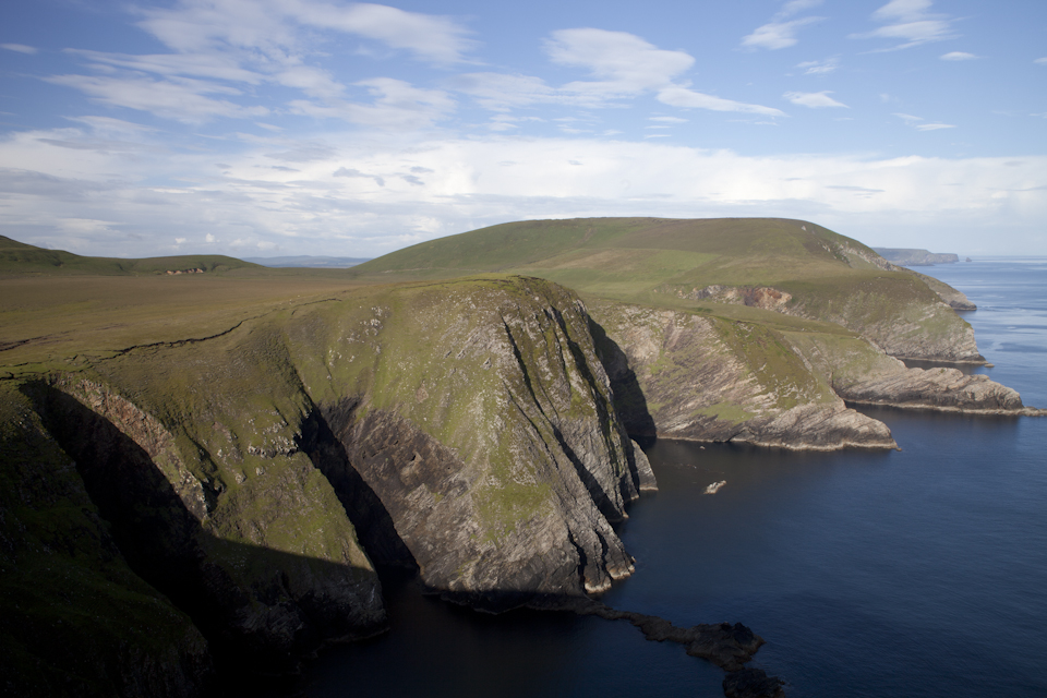
I’m an unabashed map junkie, have been for years, which means I have the rare ability to be entranced for hours on end by contour line patterns, dendritic river systems, obscure topographical symbols, and various other cartographic delights. When visiting my home in County Mayo in the West of Ireland two years ago, I resolved to finally forsake my position as armchair explorer in favour of actively exploring uncharted territory. My interest was piqued when I made the discovery that a considerable junk of North Mayo was hazy at best when viewed as a satellite image on Google Maps. It appeared as if an imaginary line had been drawn straight through Belderrig (also spelt ‘Belderg’) with all points directly west shrouded in an inexplicable fog. That was when I discovered a newfound interest in the local landscape.
Belderrig is a small coastal community in the Gaeltacht (Irish-speaking region) where life revolves around a small harbour and the other bastions of rural Irish living – a pub, a shop, a church and a school. Back in the 1930s, the local schoolmaster, Patrick Caulfield, came across a large number of unusual stones in a regular formation and depth whilst cutting turf in a nearby bog. Years later, his son, the archaeologist Professor Seamus Caulfield, discovered evidence of an extensive Stone Age field system complete with dwellings and tombs several miles further to the east. This became known as ‘Céide Fields’ – the oldest known field system in the world with a history of more than five and a half thousand years. These ancient structures have been preserved in the bogland from a time that pre-dates the Pyramids of Egypt. Who knows what other cultural treasures lie hidden beneath the veneer of bog? But radical changes are gathering apace that could leave an indelible mark on this ancient landscape.
A journey of self-discovery
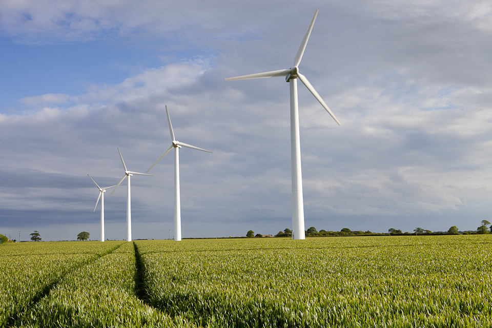
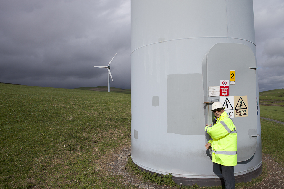
Last year, I embarked on a personal project to explore the visual impact of wind-farms on landscape in the UK through photography. I chose this topic not just because it happens to be a contentious one for many Britons but also because it was an issue I had to resolve in my own head once and for all. I travelled to East Anglia and Cumbria to document wind turbines, near to but outside of, sensitive landscapes such as the Norfolk Broads and the Lake District National Park. It’s a personal journey that has taken on an entirely new dimension since I decided to dig into my own metaphorical back yard in the West of Ireland. I resolved to take the plunge and confront my demons once and for all. I would find out whether a committed environmentalist and renewable energy enthusiast could simultaneously hide a closet NIMBY somewhere deep inside. Incidentally, I should point out that I’ve been living in London for the past nine years but you can see my point.
As so often is the case, energy and other natural resources are unfortunately mined in the most remote, unspoilt and sensitive of landscapes around the globe. With fewer people to object and largely out of sight of the media’s prying eyes, those few hardy (usually portrayed as stubborn) souls who make a stand are often left whispering in the wind. To my eyes, County Mayo is ‘frontier country’ on an Irish scale – similar to America’s Wild West in colonial times or Australia’s present day Outback. Most locals would probably laugh at me when I say this but I imagine they would also grudgingly accept that it has at least a modicum of truth.
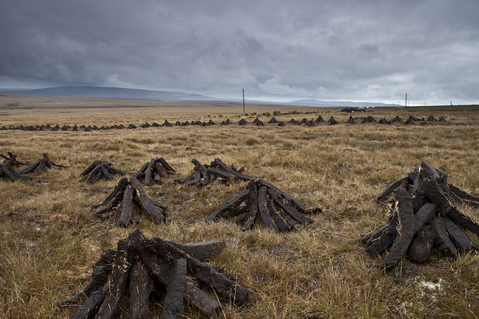
Lying almost 300km to the west of Ireland’s capital is a landscape rich in gas, peat, wind, wave and biomass. The back-breaking work of harvesting peat by hand using the traditional slean or turf-spade (and by machine more recently) has been the mainstay of local communities to survive the long winter down through the centuries. In recent times, the discovery of the Corrib gas field just fifty miles offshore has attracted the energy giant Shell which is due to open its controversial gas processing facility and pipeline in 2014. But neither of these fossil fuel resources can hold a candle to the potential of renewable energy in the county. Mayo is recognized to have the best wind and wave resource of just about anywhere in Europe. The wind- and wave-battered Atlantic coast pounds the landscape for most of the year. And now planners on the County Council are pounding their fists on the boardroom table demanding a slice of the action, and all of the investment that goes along with it.
Paying lip service to landscape concerns
County Mayo was the first of the twenty six counties in the country to draft its own comprehensive Renewable Energy Strategy (RES). It has a forward-looking County Manager and an ambition to finally put Mayo on the map – to lift that veil of mist I mentioned before and put the wind to work, so to speak. The 88-page RES document includes a collection of interesting maps at the back (well, I would say that, wouldn’t I?), one of which zones the land into Tier 1 (preferred wind farm sites) and Tier 2 (locations open for consideration). A separate 222-page Strategic Environmental Assessment report attempts to explain the rationale behind zoning the land in this way from an environmental perspective. Landscape is just one of many competing measures, such as biodiversity, water and cultural heritage, which are used to assess five alternative scenarios for future renewable energy development. From a landscape perspective, the county is broken down into sixteen different landscape types and then grouped into six Landscape Protection Policy Areas.
In summary, the report concludes that, “County Mayo’s eastern landscapes (Policy Area 4) are the most robust in the County and are least sensitive to change. All other landscapes are highly sensitive to change.” Unfortunately in terms of wind resource, the east of the county has far less potential than the north and west and so you would imagine a clash is on the cards. Not so though. The SEA report concludes that Scenario 4 is the most environmentally sustainable of the five scenarios for renewable energy development although they admit that “there is the potential for conflict with environmental protection objectives in respect of……cultural heritage and landscape.” The report goes on to say that Scenario 4 is “the best as it would take into consideration all types of landscapes identified in the Landscape Appraisal for County Mayo”. This indicates to the reader that the County Council mustn’t view a distinction between their own landscape policy areas after all if their over-riding concern is to consider all landscape types and imply they somehow have equal status. And so it would appear that although the Council has come up with a comprehensive strategy and rigorous set of indicators and policy areas, it is not prepared to apply its own methodology to objectively assess landscape concerns. What we get is an illusion of compromise and tacit support for the industrial-scale development of a largely untouched rural landscape to suit the ends of the policy-makers.
Why does it matter that we protect our landscape?
The Irish sense of identity is intricately bound with our landscape, our language, our literature and our long history of struggle. Take any one of these away and we are all the less Irish for it. Having said that, I did a pretty good job of not just ignoring, but actively shunning the rural tranquility of my home county as I was growing up. But those days passed over as I matured and gained some renewed perspective from afar. We need to recognize that landscapes change and evolve; typically over centuries and millennia when it comes to natural processes, or days and years with the tools of human endeavour. Another pressing concern is the effect that man-made climate change is having on landscape – eroding coastlines due to sea-level rise, flooding agricultural land, and in the case of Mayo, triggering bogslides (similar to landslides but it is the bog that slips downhill).
The great Irish poet and Nobel Laureate, Seamus Heaney, visited Belderrig and wrote the opening lines to this poem as a thank-you letter to Patrick Caulfield in 1975. This prehistoric landscape continues to inspire poets, writers and artists although it is largely unknown to the outside world. The reputation that Ireland enjoys abroad precedes itself and is at least partly based upon the romantic notion that many foreigners (especially Americans of Irish heritage) have of our landscape, culture and traditions. What if I were to say to you that it is exceedingly rare in today’s Ireland to come across a landscape that doesn’t carry a significant man-made footprint? White-washed houses are a particularly dominant feature dotting the rural countryside and drawing the eye in from afar. But out west, there still lies a handful of wide open landscapes that have remained unchanged for millennia – mostly because the land was too poor, too hilly, and too wet to graft a living from. We should protect these last remaining pockets of our natural heritage, not for romantic or sentimental reasons but because once they are lost to development, there’s very little chance of turning back the clock. Our resilience to the harsh elements, our stubbornness in the face of adversity, our pressing need to have the craic and tell tall stories in the local pub – all of these qualities and much more come from a sense of identity that is shaped by the very same elements that have moulded the landscape over millennia.
An all-or-nothing approach to development
If we accept that development of any type necessitates changes to the landscape and that there is also a pressing need to pursue our renewable energy ambitions, then it just become a question of what development in which landscape, and to what extent. Mayo is recognized as having one of the best wind and wave resources in all of Europe. Yet, it lies far from the population centres that can draw down this power. In fact, according to the developers of the Mayo Atlantic Renewable Energy Export (MAREX) project, Mayo has such an abundance of raw power that sufficient demand does not exist on the entire island of Ireland. Together with an undeveloped electricity grid, this has become the basis of a proposal to develop the single largest energy infrastructure project ever undertaken in Ireland. Organic Power intends to develop a massive 2GW (2,000MW) of wind power in North Mayo by 2018 if it can secure planning permission. That means sinking 450 wind turbines into the boggy landscape, constructing a 1.5GW hydro energy storage hub and laying down a 500-kilometre HVDC cable across the country and under the Irish Sea to feed into the much larger UK market. This project can only succeed at scale – there are all kinds of price pressures that dictate it’s all or nothing approach. Landscape is only a consideration in terms of whether the project can meet the lenient policy set by the County Council that is open to interpretation and whether it can appease An Bord Pleanala (the Irish planning board) who are already under significant pressure to wave through what has been termed a ‘strategic infrastructure project’ for the country.
Not all landscapes are equal
MAREX is not the only wind farm mega-project in Ireland proposed to export wind energy to the UK. Element Power has an even more ambitious £8 billion ‘Greenwire’ proposal to develop 700 wind turbines and generate 3GW of electricity in The Bog of Allen – far removed from the west coast. Bord na Mona, the semi-state body responsible for the mechanized harvesting of peat, has left behind a wide-scale legacy of cutaway bog in the Midlands. Milled, harrowed, ridged and harvested by specialized machinery, the peat is then transported on specially constructed narrow-gauge railways for burning at one of only three remaining peat power stations – Edenderry, Lough Ree and West Offaly. This landscape may share a common resource with that of North Mayo but therein end any similarities. The Bog of Allen is largely an industrial landscape that has been, and continues to be, stripped of peat on a large scale. It has long been sacrificed in the name of development.
The wind may not blow as frequently or as strongly in the Midlands compared to the West but this is a landscape that is far better suited to large-scale development in terms of environmental impact and visual amenity. However, that is not to say that there isn’t room for any wind farm development in North Mayo. Bord na Mona and ESB (the semi-state power utility) received planning permission for a 112-turbine wind farm (originally 180 turbines) back in 2003 on cutaway bog at Oweninny, next to the former Bellacorrick peat-burning power station. In fact, Ireland’s first wind farm was constructed on the same bogland in 1992 and its twenty one turbines are turning in the wind to this day. The Oweninny development is more appropriate for the county than the MAREX project on several fronts. This area is cutaway bog, a scarred landscape as such, similar to but much smaller in scope than the Midlands. Wind turbines already exist in the vicinity and although the proposed development is sizeable, it’s still only a quarter of the MAREX project in terms of turbine numbers. And lastly, this power is for Irish consumers, Ireland’s energy security and contributes to Ireland’s climate change targets.
Meanwhile a very modest 23MW wind farm proposed by Killala Community Wind Farm Ltd less than 20 miles to the east of Belderrig has been unable to get off the ground due to visual impact concerns. This is in spite of the fact that the development would be owned by the local community and that it is located in least sensitive landscape to development ( Policy Area 4 – Landscape Appraisal of County Mayo).
Industrialization of a landscape
If the Organic Power project were to proceed alongside this development, the rural landscape of North Mayo would need to somehow absorb almost 600 wind turbines. This would represent the most significant industrialization of a rural landscape in Ireland due to the cumulative impact of such a massive undertaking. It would also be the single largest onshore wind farm project anywhere in the world. North Mayo is home to one of the last significant tracts of blanket bog found anywhere in Europe. If we are to scale up our renewable energy ambitions by planting an equivalent number of wind turbines in the country, then we should do so on flat land already ‘strip-mined’ such as that found on the Bog of Allen. But there is a larger, more fundamental question here. Should the UK outsource it’s renewable energy needs to another country just because a Conservative government has no desire to rile its voter base in rural England? And where do carbon emissions and climate change targets fit in with all of this? It should be remembered that any power exported to the UK will not go towards Ireland’s 2020 targets to source 40% of electricity from renewable sources under the EU 2009 Renewable Energy Directive.
Admittedly, the wind does not blow quite as strongly or as predictably in the Midlands compared to in Mayo. But that does not mean it is any less appropriate to develop. Let’s take it as a given that we cannot scale up renewable energy sufficiently unless it makes sound economic sense. Conventional accounting does not take into account the true value of land – only it’s development potential. If we were to price ecosystem services such as storing carbon, flood control, providing habitat and then add in the value of landscape in terms of tourism, recreation, health, education, history, culture, and spiritual needs, we would come up with a far different end figure. Suddenly it would become very expensive indeed to build a 450-turbine wind farm on the boglands of North Mayo.
Maps cannot chart the soul of a landscape
Back to those unusual stones that Patrick Caulfield found all those years ago at Belderrig barely one and a half miles from Glinsk mountaintop – location for the proposed MAREX hydro energy storage facility. Evidence for prehistoric tillage in the region was uncovered in the form of the first plough-marks – the earliest proven use of a plough anywhere in Europe. Or as Heaney far more eloquently put it –
To lift the lid of the peat
And find this pupil dreaming
Of neolithic wheat!
A second wave of occupation occurred in the Bronze Age in order to mine the rich vein of copper ore in the cliff face one mile to the north-west. This would be right next to the proposed reservoir and pumped hydro storage at Glinsk. The land around here hasn’t changed much in all those intervening years. What other buried treasures potentially lie beneath the ancient peat?
I believe in the need to scale up renewable energy more than ever – in part as a force to protect sensitive landscapes by helping to reduce carbon emissions and the resulting physical impacts of man-made climate change. I am as committed as ever to the siting of wind farms in the most appropriate landscapes. But we must not relent to the pressure to push wind farms into ever more remote and sensitive landscapes so that they too are branded by the Hand of Man. By implication, wind farms and human settlement will somehow need to co-exist in greater harmony. Local communities can be engaged and a respectful distance for noise and shadow flicker can be achieved.
I don’t get the chance to visit North Mayo as much as I’d like these days. It’s not quite in my back yard anymore but I still feel a strong tug westward as I sit typing in London. I’m still a committed renewable energy enthusiast and environmentalist. Whether I’m a NIMBY or not, I’ll let you be the judge of that.
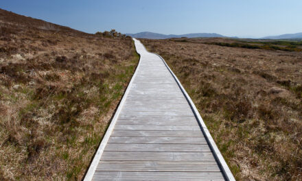
The landscape of North Mayo remains as mysterious as it ever was to me. Buried treasures under the ancient peat. A bleak, boggy, beautiful wilderness. Perhaps it was never meant to be mapped out in detail or spied on from afar by some satellite orbiting the earth? It can only be known by taking a lungful of sharp salty Atlantic air, feeling the spring of heather and the squelch of bog underfoot, and above all, gazing upon the clouds scuttling across the vastness of an untouched landscape lost in time.
Originally published in 2013

Recent Comments